I had an appointment in Lexington Friday mourning and decided to do a little geocaching.
Started with Rocky Ridge Multicache. Found it. SL/TNLN/TFTC. I'd checked this out online before departing. There is good parking at the office park S of the cache and a trail leading in. This makes the route only about 2000'.
It was an easy walk to the stage 1 GZ over open snow free trails. Stage 2 was back the way I came in so I turned back and quickly found the ridge. There are some interesting views from the ridge.
The cache is nearby and was completely visible.
I opened it and signed the log. I added some cover material when I replaced it.
While I was in the area I decided to try the nearby Send Out Succour to Juniper Hill. There is good parking at the end of Barberry Rd. and it's an easy walk through wetland to GZ for stage 1. You need to cross a number of streams but there are nice plank bridges.
I found stage 1 fairly quickly and got the Morse code for stage 2. My Morse is a bit rusty (being old and a geek is occasionally useful) but armed with the coordinates for stage 2 I continued down the trail. This seemed to lead to someone's yard so I doubled back and returned to a trail heading N toward GZ through the wetland. It was occasionally muddy but passable the day I was there. Eventually the trail turned W toward the stage 2 GZ. This was in an interesting open hill.
I spent about 40 minutes looking for stage 2 but DNF.
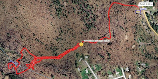
I drove home and had some lunch. Afterward, I decided to try Greenwood Memorial Cache again. BB and I had tried this cache Thursday but DNF. I'd studied the plaques and realized that I might have made a mistake when I solved the stage 1 puzzle. Armed with a new set of coordinates I decided to try again. This was one of THOSE experiences involving 2.33mi of hiking and ANOTHER DNF after walking to the new stage 2 coordinates not finding the cache again, walking back to the graves, calculating another stage 2 coordinate (made a simple error) walking back to the the new new stage 2 not finding it there wandering through the wetland and loosing a glove on the way back to my car.
Occasionally geocaching is like that.
Today (Saturday) I decided to try yet again and hopefully find my lost glove. Before starting out I reviewed the cache logs and photos carefully. I decided to try at another GZ with the 1003 offset and the image of the Girl Scout find. Armed with this new information BB and I went out again and quickly walked in. Sure enough it was at the new new new GZ.
The coordinates for the final are definitely bogus! While at the final stage I took a number of GPS readings under clear skies with good GPS accuracy at the final coordinates and computed a new set of final stage puzzle factors. The N factor I got is 1553 and the W factor is 1000.
I signed the log and BB and I hiked back out.
As usual here are all the photos from this 2 day adventure. There are some spoilers.


No comments:
Post a Comment